
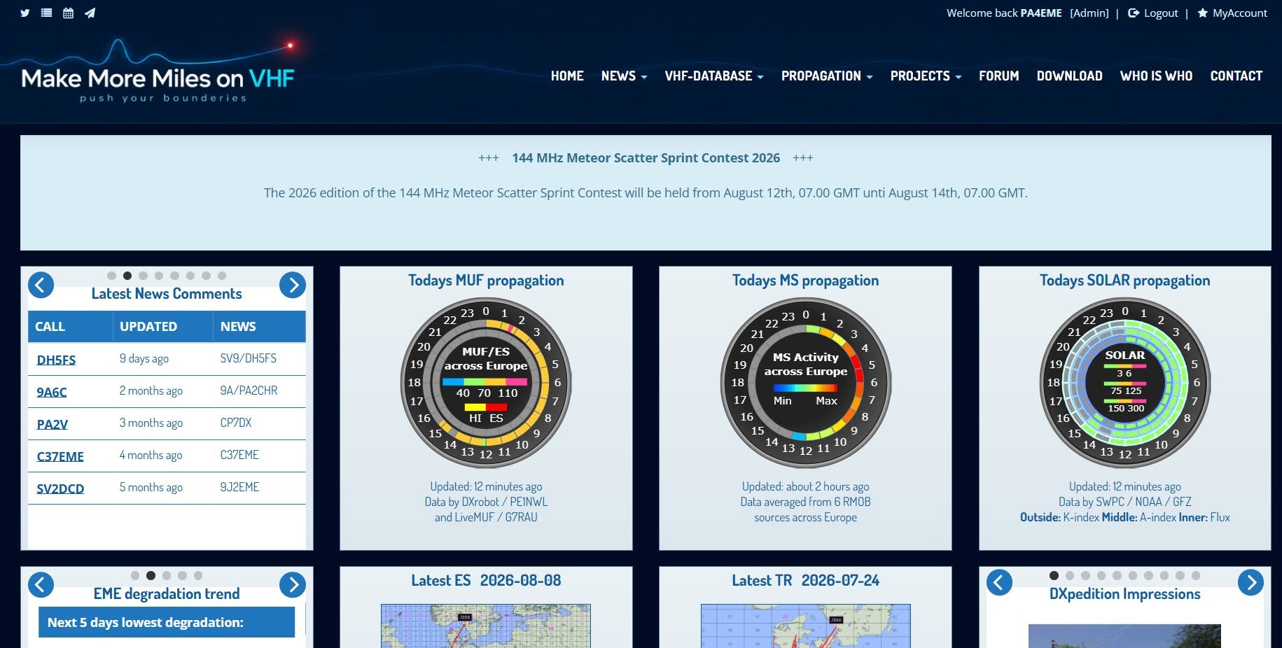
Make More Miles on VHF (MMMonVHF) has long been one of the key sources of information for VHF operátorov v Európe – sústreďuje správy o expedíciách na pásme 144 MHz, teoretické články o šírení vĺn, QSL information and an extensive VHF database. The site is managed by a team of administrators Guido DL8EBW, Erwin DK5EW, Peter PA3BIY, Jani HA5CRX, Ans DK2KBC, Peter OZ1LPR and Bernd DK3XT/AB3IY. The site has recently undergone a modernization of its appearance and technical background, while maintaining the usual functions and extensive historical data.
In the article you will read
What does MMMonVHF bring to the VHF operator?
The improved interface is clearer, wider and better adapted to current screens. One of the biggest innovations is the integrated map generator directly in the MMMonVHF system - Sporadic E, Tropo and Aurora propagation maps can now be created directly from sent QSO data, without the need for external software. The maps automatically adjust their center and scale and include coastlines, lakes, state borders and the Maidenhead locator grid.

Special attention is required for mapping the aurora, as the signal does not bounce directly between stations in this type of propagation, but passes through the aurora region. The new system therefore works with station locators, reported antenna directions and an approximate reflection height of 100 km. Red paths on the map indicate that the report was received by both participating stations, while blue paths represent the estimated geometry in the event that only one of the stations sent the report. The system also includes additional checks that reject implausible paths and prevent incorrect data from creating an unrealistic view of the map.
The generated maps remain subject to review by the responsible editor of MMMonVHF. They are carefully constrained visual reconstructions, not precise scientific measurements of the polar oval.
Previously, maps had to be created using external, legacy software, manually edited, and then uploaded separately to the site. The new workflow is faster, more consistent, and fully integrated directly into MMMonVHF, while the original maps remain available as a backup.
New design MMMonVHF

The update also includes improved site availability via a mirror server. https://www.mmmonvhf.eu/Some visitors from certain regions have had trouble accessing MMMonVHF, as the hosting provider has had to block entire IP ranges for security reasons. For these visitors, MMMonVHF remains available via a mirror site protected by Cloudflare at mmmonvhf.eu.
The operators also warn that the mirror site may sometimes be slower to respond. Cloudflare works exceptionally well for static websites, but MMMonVHF contains a lot of dynamic pages, live database queries, and frequently updated promotional data that cannot always be cached as effectively as static content. Therefore, the operators recommend using a primary .de domain whenever possible.
Summary
MMMonVHF has undergone a technical and visual renovation, while maintaining its main role - a central source of information about VHF expeditions, propagation and QSL service for the community around the 144 MHz band. A key innovation is the integrated generator of Sporadic E, Tropo and Aurora maps directly from sent QSO data, supplemented by a mirror site for visitors with limited access to the primary domain. The site is available at www.mmmonvhf.de, possibly through a mirror www.mmmonvhf.eu.